
Batea topographic map
Interactive map
Click on the map to display elevation.
About this map
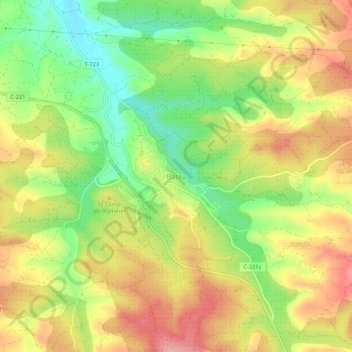
Name: Batea topographic map, elevation, terrain.
Location: Batea, Tierra Alta, Tarragona, Cataluña, 43786, España (41.07428 0.29406 41.11428 0.33406)
Average elevation: 371 m
Minimum elevation: 296 m
Maximum elevation: 444 m