Geolocate

Tithi topographic map

Click on the map to display elevation.

About this map

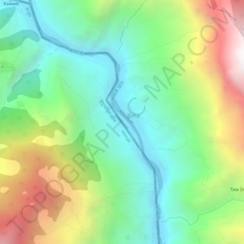
Name: Tithi topographic map, elevation, terrain.

Location: Tithi, Hyanglu, Khatyad, Mugu, Karnali Pradesh, Nepal (29.56623 81.77142 29.60623 81.81142)

Average elevation: 1,835 m

Minimum elevation: 1,142 m

Maximum elevation: 3,121 m

Gear up for your next adventure:

🥤Collapsible Travel Cup - Saves space and weight in your mess kit
🧥Thermal Layer - Insulating layer for cold outdoor conditions
🥾Mountaineering Boots - Supportive boots for climbing and high-altitude hiking
Camping Essentials - All-in-one gear for a comfortable camping trip
🛰️Satellite Messenger - Emergency communication for areas with no cell service

As an Amazon Associate, this site earns from qualifying purchases at no extra cost to you.