Geolocate

Sublessy topographic map

Click on the map to display elevation.

About this map

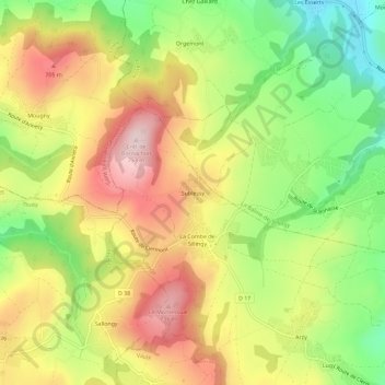
Name: Sublessy topographic map, elevation, terrain.

Location: Sublessy, Sillingy, Annecy, Haute-Savoie, Auvergne-Rhône-Alpes, France métropolitaine, 74330, France (45.94552 5.97940 45.98552 6.01940)

Average elevation: 603 m

Minimum elevation: 453 m

Maximum elevation: 753 m

Other topographic maps

Click on a map to view its topography, its elevation and its terrain.

Gear up for your next adventure:

🧊Insulated Water Bottle - Keeps drinks cold in summer and prevents freezing in winter
🦶Anti-Blister Balm - Prevents friction and hotspots during long ascents
👖Convertible Hiking Pants - Zip-off legs to adapt to changing weather conditions
🍽️Titanium Camping Spork - Ultralight and indestructible eating utensil
🥾Mountaineering Boots - Supportive boots for climbing and high-altitude hiking

As an Amazon Associate, this site earns from qualifying purchases at no extra cost to you.