Geolocate

Tavertet topographic map

Click on the map to display elevation.

About this map

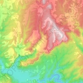
Name: Tavertet topographic map, elevation, terrain.

Location: Tavertet, Osona, Barcelona, Catalonia, 08511, Spain (41.97583 2.34295 42.03635 2.45464)

Average elevation: 759 m

Minimum elevation: 335 m

Maximum elevation: 1,184 m

Other topographic maps

Click on a map to view its topography, its elevation and its terrain.

Pla de la Calma

Spain > Catalonia > Osona > el Brull

Average elevation: 1,111 m

Gear up for your next adventure:

🔨Vehicle Emergency Tool - Safety tool for remote road trips to trailheads
🌡️Emergency Mylar Blankets - Compact thermal protection for unexpected nights outdoors
🥾Waterproof Hiking Shoes - Durable shoes for wet and rugged trails
🛁Quick-Dry Microfiber Towel - Space-saving towel that dries rapidly on the move
🥾Approach Boots - Comfortable boots for hiking and climbing approaches

As an Amazon Associate, this site earns from qualifying purchases at no extra cost to you.