
Make a donation
Gear up for your next adventure:
As an Amazon Associate, this site earns from qualifying purchases at no extra cost to you.
Lac de Réghaïa topographic map
Click on the map to display elevation.
Make a donation
Gear up for your next adventure:
As an Amazon Associate, this site earns from qualifying purchases at no extra cost to you.
Lac de Réghaïa
Le plan d’eau est associé à une plaine littorale à faible altitude, avec des gradients entre l’amont (zones d’entrée d’eau et d’apports anthropiques) et l’aval (secteur plus proche de la dune et du débouché vers la mer).
Make a donation
Gear up for your next adventure:
As an Amazon Associate, this site earns from qualifying purchases at no extra cost to you.
About this map
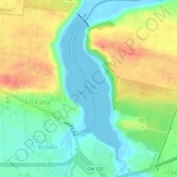
Name: Lac de Réghaïa topographic map, elevation, terrain.
Location: Lac de Réghaïa, Braïdia, Herraoua, Daïra Rouiba, Alger, Algérie (36.75809 3.33005 36.78039 3.34172)
Average elevation: 22 m
Minimum elevation: -4 m
Maximum elevation: 53 m
Make a donation
Gear up for your next adventure:
As an Amazon Associate, this site earns from qualifying purchases at no extra cost to you.