Geolocate

Dare County topographic map

Click on the map to display elevation.

About this map

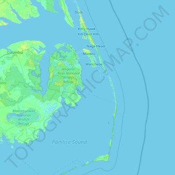
Name: Dare County topographic map, elevation, terrain.

Location: Dare County, North Carolina, United States (35.14057 -76.02748 36.24498 -75.40012)

Average elevation: 1 m

Minimum elevation: -3 m

Maximum elevation: 17 m

Other topographic maps

Click on a map to view its topography, its elevation and its terrain.

Gear up for your next adventure:

🧦Crew Hiking Socks - Comfortable socks for long-distance hikes
🧢Hiking Sun Hat - Wide-brimmed protection for exposed mountain ridges
🥾Trail Hiking Shoes - Durable shoes designed for rugged trails
🌡️Emergency Mylar Blankets - Compact thermal protection for unexpected nights outdoors
🥾Light Trekking Boots - Supportive boots for multi-day treks

As an Amazon Associate, this site earns from qualifying purchases at no extra cost to you.