Geolocate

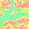
Busia Mountain topographic map

Click on the map to display elevation.

About this map

Name: Busia Mountain topographic map, elevation, terrain.

Location: Busia Mountain, Denali Borough, Alaska, United States (63.50343 -150.98483 63.50353 -150.98473)

Average elevation: 809 m

Minimum elevation: 543 m

Maximum elevation: 995 m

Other topographic maps

Click on a map to view its topography, its elevation and its terrain.
Anderson

United States > Alaska > Denali Borough

Average elevation: 171 m

Cantwell

United States > Alaska > Denali Borough

Average elevation: 1,104 m

Foraker Glacier

United States > Alaska > Denali Borough

Average elevation: 2,100 m

Denali Park

United States > Alaska > Denali Borough

Average elevation: 1,050 m

Anderson

United States > Alaska > Denali Borough

Average elevation: 171 m

Cantwell

United States > Alaska > Denali Borough

Average elevation: 1,104 m

Cantwell

United States > Alaska > Denali Borough

Average elevation: 1,104 m

Gear up for your next adventure:

🧢Hiking Hat - Sun-protective and breathable hats for long treks
🥽Outdoor Goggles - Protective eyewear for outdoor activities
🔥Emergency Fire Starter - Reliable ignition source for all weather conditions
🧼Travel Hand Sanitizer - Keep hands clean when water is scarce
🦯Trekking Poles - Reduced impact on joints for steep topographic climbs

As an Amazon Associate, this site earns from qualifying purchases at no extra cost to you.