Geolocate

Aceitunilla topographic map

Click on the map to display elevation.

About this map

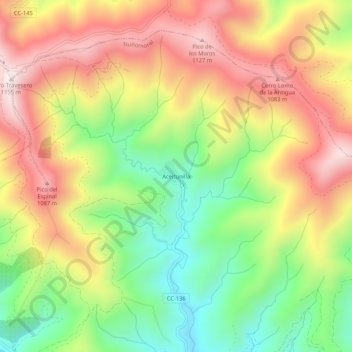
Name: Aceitunilla topographic map, elevation, terrain.

Location: Aceitunilla, Nuñomoral, Cáceres, Extremadura, 10626, España (40.41519 -6.26206 40.45519 -6.22206)

Average elevation: 817 m

Minimum elevation: 494 m

Maximum elevation: 1,147 m

Gear up for your next adventure:

🔨Vehicle Emergency Tool - Safety tool for remote road trips to trailheads
🥾Trekking Poles - Adjustable trekking poles to reduce knee stress and improve stability
🥾Hiking Leggings - Comfortable leggings for outdoor activities
🗺️Topographic Maps - Detailed maps to explore trails, mountains, and wilderness areas
🥽Outdoor Goggles - Protective eyewear for outdoor activities

As an Amazon Associate, this site earns from qualifying purchases at no extra cost to you.