Geolocate

Forestville topographic map

Click on the map to display elevation.

About this map

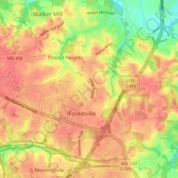
Name: Forestville topographic map, elevation, terrain.

Location: Forestville, Prince George's County, Maryland, United States (38.82557 -76.89183 38.87960 -76.84467)

Average elevation: 73 m

Minimum elevation: 38 m

Maximum elevation: 91 m

Gear up for your next adventure:

🥾Trail Hiking Boots - Supportive boots for rough trails
🎒Hiking Daypack - Lightweight and durable backpacks for day trips and excursions
🥾All-Terrain Hiking Boots - Versatile boots for varied hiking conditions
🥾Trail Running Shoes - Lightweight and durable shoes for trail running
🕯️Camping Lantern - Illuminates your entire campsite with high-efficiency LEDs

As an Amazon Associate, this site earns from qualifying purchases at no extra cost to you.