
Thank you for supporting this site ❤️
Make a donation
Make a donation
Gear up for your next adventure:
As an Amazon Associate, this site earns from qualifying purchases at no extra cost to you.
Collelungo topographic map
Click on the map to display elevation.
Thank you for supporting this site ❤️
Make a donation
Make a donation
Gear up for your next adventure:
As an Amazon Associate, this site earns from qualifying purchases at no extra cost to you.
About this map
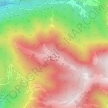
Name: Collelungo topographic map, elevation, terrain.
Location: Collelungo, Leonessa, Rieti, Lazio, Italia (42.55129 12.90426 42.55139 12.90436)
Average elevation: 1,374 m
Minimum elevation: 939 m
Maximum elevation: 1,698 m
Thank you for supporting this site ❤️
Make a donation
Make a donation
Gear up for your next adventure:
As an Amazon Associate, this site earns from qualifying purchases at no extra cost to you.