
Thank you for supporting this site ❤️
Make a donation
Make a donation
Gear up for your next adventure:
As an Amazon Associate, this site earns from qualifying purchases at no extra cost to you.
Xillán topographic map
Click on the map to display elevation.
Thank you for supporting this site ❤️
Make a donation
Make a donation
Gear up for your next adventure:
As an Amazon Associate, this site earns from qualifying purchases at no extra cost to you.
About this map
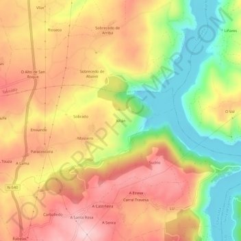
Name: Xillán topographic map, elevation, terrain.
Location: Xillán, Pedrafita, Chantada, Lugo, Galicien, 27595, Spanien (42.63761 -7.76652 42.67761 -7.72652)
Average elevation: 465 m
Minimum elevation: 324 m
Maximum elevation: 581 m
Thank you for supporting this site ❤️
Make a donation
Make a donation
Gear up for your next adventure:
As an Amazon Associate, this site earns from qualifying purchases at no extra cost to you.