Geolocate

Lake Forest topographic map

Click on the map to display elevation.

About this map

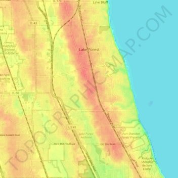
Name: Lake Forest topographic map, elevation, terrain.

Location: Lake Forest, Lake County, Illinois, 60045, United States (42.20345 -87.90201 42.27982 -87.80698)

Average elevation: 199 m

Minimum elevation: 173 m

Maximum elevation: 223 m

Gear up for your next adventure:

🔦LED Flashlight - Powerful and long-lasting flashlight for camping and emergencies
🧴First Aid Kit - Essential first aid supplies for outdoor emergencies
🔦LED Headlamp - Hands-free lighting for early morning starts or late finishes
🥾Trail Running Boots - Durable shoes designed for trail running
🥾Waterproof Hiking Shoes - Durable shoes for wet and rugged trails

As an Amazon Associate, this site earns from qualifying purchases at no extra cost to you.