
Keravezan topographic map
Click on the map to display elevation.
About this map
Name: Keravezan topographic map, elevation, terrain.
Average elevation: 6 m
Minimum elevation: 0 m
Maximum elevation: 24 m
Other topographic maps
Click on a map to view its topography, its elevation and its terrain.
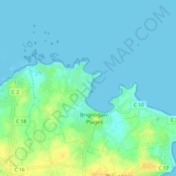
Brignogan-Plages
France > Bretagne > Finistère > Plounéour-Brignogan-Plages
Située à 15 mètres d'altitude et voisine des communes de Plounéour-Trez (avec laquelle elle a fusionné en 2017) et de Kerlouan. Les plus grandes agglomérations situées à proximité sont Lesneven, distante de 10 kilomètres, Landerneau, cette dernière ville se trouvant à 24 km au sud-est et Brest…
Average elevation: 6 m
Plounéour-Trez
France > Bretagne > Finistère > Plounéour-Brignogan-Plages
D'assez vaste superficie (10,68 km2), la commune possède une campagne assez étendue, plate pour l'essentiel, sauf dans sa partie sud-ouest qui atteint 45 mètres d'altitude près du hameau de Toulran, mais la majeure partie du finage communal est à moins de 20 mètres d'altitude.
Average elevation: 15 m