Geolocate

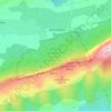
Valentine topographic map

Click on the map to display elevation.

About this map

Name: Valentine topographic map, elevation, terrain.

Location: Valentine, Plan-d'Aups-Sainte-Baume, Brignoles, Var, Provence-Alpes-Côte d'Azur, France métropolitaine, 83640, France (43.31166 5.67611 43.35166 5.71611)

Average elevation: 688 m

Minimum elevation: 293 m

Maximum elevation: 1,042 m

Other topographic maps

Click on a map to view its topography, its elevation and its terrain.
Gear up for your next adventure:

☕Camping Coffee Maker - Brew fresh coffee anywhere on the topographic map
🔥Emergency Fire Starter - Reliable ignition source for all weather conditions
🔋Lithium AA Batteries - Long-lasting power that performs in extreme cold
🛁Quick-Dry Microfiber Towel - Space-saving towel that dries rapidly on the move
🕯️Camping Lantern - Illuminates your entire campsite with high-efficiency LEDs

As an Amazon Associate, this site earns from qualifying purchases at no extra cost to you.