Geolocate

Polvora topographic map

Click on the map to display elevation.

About this map

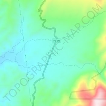
Name: Polvora topographic map, elevation, terrain.

Location: Polvora, Pólvora, Tocache, San Martín, Perú (-7.92760 -76.68820 -7.88760 -76.64820)

Average elevation: 608 m

Minimum elevation: 471 m

Maximum elevation: 995 m

Gear up for your next adventure:

🚲MTB Frame Bag - Carry tools and maps directly on your bicycle frame
🪜Heavy Duty Carabiners - Multi-use clips for securing gear to your backpack
🧦Thermal Socks - Warm socks for winter hiking or camping
🛏️Sleeping Bag - Warm and compact sleeping bags for outdoor camping
🔨Vehicle Emergency Tool - Safety tool for remote road trips to trailheads

As an Amazon Associate, this site earns from qualifying purchases at no extra cost to you.