Geolocate

Cajamarca topographic map

Click on the map to display elevation.

About this map

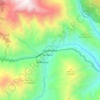
Name: Cajamarca topographic map, elevation, terrain.

Location: Cajamarca, Centro, Tolima, Colombia (4.40197 -75.46682 4.48197 -75.38682)

Average elevation: 2,247 m

Minimum elevation: 1,491 m

Maximum elevation: 3,571 m

Gear up for your next adventure:

🩹Moleskin Blister Pads - Direct protection for painful foot pressure points
💧Filtered Water Bottle - Safe drinking water on the go
Backpacking Tent - Lightweight tent for long-distance hiking trips
🧣Merino Neck Gaiter - Protects against wind, sun, and cold at high altitudes
🎒Hiking Backpack - Lightweight and ergonomic backpacks for day hikes or multi-day treks

As an Amazon Associate, this site earns from qualifying purchases at no extra cost to you.