Geolocate

Puyi topographic map

Click on the map to display elevation.

About this map

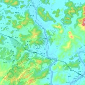
Name: Puyi topographic map, elevation, terrain.

Location: Puyi, Yangshuo County, Guilin, Guangxi, China (24.63691 110.51693 24.74458 110.61448)

Average elevation: 199 m

Minimum elevation: 91 m

Maximum elevation: 671 m

Other topographic maps

Click on a map to view its topography, its elevation and its terrain.

ShiBanQiao

China > Guangxi > Yangshuo County > Guilin

Average elevation: 160 m

Gear up for your next adventure:

🧢Sun Hat - Wide-brim hat for sun protection
🧴Waterproofing Spray - Restore the DWR coating on jackets and tents
🪑Insulated Seat Pad - Protect your seat from cold rocks and wet logs
🩹Compact First Aid Kit - Pre-packed essentials for common trail injuries
🧼Travel Hand Sanitizer - Keep hands clean when water is scarce

As an Amazon Associate, this site earns from qualifying purchases at no extra cost to you.