Geolocate

Fiscaglia topographic map

Click on the map to display elevation.

About this map

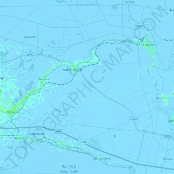
Name: Fiscaglia topographic map, elevation, terrain.

Location: Fiscaglia, Unione Delta del Po, Ferrara, Emilia-Romagna, Italy (44.74772 11.88904 44.83749 12.11445)

Average elevation: -2 m

Minimum elevation: -6 m

Maximum elevation: 8 m

Other topographic maps

Click on a map to view its topography, its elevation and its terrain.

Tamara

Italy > Emilia-Romagna > Ferrara > Copparo

Average elevation: 3 m

Lido di Pomposa

Italy > Emilia-Romagna > Ferrara > Comacchio

Average elevation: 0 m

Montalbano

Italy > Emilia-Romagna > Ferrara > Ferrara

Average elevation: 9 m

Gear up for your next adventure:

🧴Sunscreen SPF - Broad-spectrum sunscreen for outdoor activities
🥾Waterproof Hiking Shoes - Durable shoes for wet and rugged trails
🥾Trail Hiking Socks - Comfortable socks to prevent blisters and fatigue
🔭Compact Binoculars - Lightweight optics for scouting trails and wildlife
Backpacking Tent - Lightweight tent for long-distance hiking trips

As an Amazon Associate, this site earns from qualifying purchases at no extra cost to you.