
Damortis topographic map
Click on the map to display elevation.
About this map
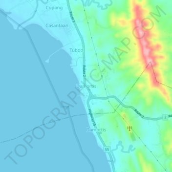
Name: Damortis topographic map, elevation, terrain.
Location: Damortis, Santo Tomas, La Union, Ilocos Region, Philippines (16.22250 120.38489 16.26250 120.42489)
Average elevation: 25 m
Minimum elevation: -1 m
Maximum elevation: 154 m
Other topographic maps
Click on a map to view its topography, its elevation and its terrain.
Agoo-Damortis Protected Landscape and Seascape
Philippines > La Union > Santo Tomas
Average elevation: 9 m