Geolocate

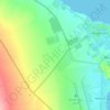
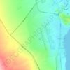
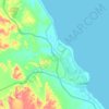
Hala'ib topographic map

Click on the map to display elevation.

About this map

Name: Hala'ib topographic map, elevation, terrain.

Location: Hala'ib, Red Sea, Egypt (22.20375 36.62758 22.24375 36.66758)

Average elevation: 9 m

Minimum elevation: -7 m

Maximum elevation: 39 m

Other topographic maps

Click on a map to view its topography, its elevation and its terrain.
Al Qusair City

Egypt > Red Sea

Average elevation: 47 m

Al Qusair City

Egypt > Red Sea

Average elevation: 47 m

Industrial Area

Egypt > Red Sea

Average elevation: 38 m

Gulf of Suez

Egypt > Red Sea

Average elevation: 481 m

Wadi Allaqi

Egypt > Red Sea

Average elevation: 377 m

Gulf of Suez

Egypt > Red Sea

Average elevation: 481 m

Marsa Alam City

Egypt > Red Sea

Average elevation: 19 m

Geziret Tubya

Egypt > Red Sea > Safaja

Average elevation: 0 m

Al Hadaba

Egypt > Red Sea

Average elevation: 41 m

Wadi Gemal

Egypt > Red Sea

Average elevation: 374 m

Gamsha

Egypt > Red Sea

Average elevation: 47 m

Al Hadaba

Egypt > Red Sea

Average elevation: 41 m

Safaja

Egypt > Red Sea

Average elevation: 1 m

Industrial Area

Egypt > Red Sea

Average elevation: 38 m

Gulf of Suez

Egypt > Red Sea

Average elevation: 481 m

Gear up for your next adventure:

🧦Crew Hiking Socks - Comfortable socks for long-distance hikes
💡Solar Camping Lamp - Eco-friendly lighting for campsites
💡LED Camping Lantern - Illuminate your campsite with long-lasting lanterns
🧴Waterproofing Spray - Restore the DWR coating on jackets and tents
🔋Emergency Crank Radio - Weather alerts and power without needing batteries

As an Amazon Associate, this site earns from qualifying purchases at no extra cost to you.