Geolocate

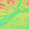
Midway topographic map

Click on the map to display elevation.

About this map

Name: Midway topographic map, elevation, terrain.

Location: Midway, Gadsden County, Florida, 32343, United States (30.47334 -84.51853 30.52862 -84.39749)

Average elevation: 41 m

Minimum elevation: 19 m

Maximum elevation: 76 m

Other topographic maps

Click on a map to view its topography, its elevation and its terrain.
Suber Dam

United States > Florida > Gadsden County

Average elevation: 78 m

Lake Talquin

United States > Florida > Gadsden County

Average elevation: 40 m

Hinson

United States > Florida > Gadsden County

Average elevation: 71 m

Gear up for your next adventure:

💡LED Camping Lantern - Illuminate your campsite with long-lasting lanterns
🧤Thermal Hiking Gloves - Grip-enhanced gloves for cold-weather altitude trekking
🥾Approach Boots - Comfortable boots for hiking and climbing approaches
🛶Kayak Dry Bag - Waterproof storage for kayaking adventures
🥾All-Terrain Hiking Boots - Versatile boots for varied hiking conditions

As an Amazon Associate, this site earns from qualifying purchases at no extra cost to you.