Geolocate

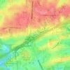
Patton Chapel topographic map

Click on the map to display elevation.

About this map

Name: Patton Chapel topographic map, elevation, terrain.

Location: Patton Chapel, Hoover, Jefferson County, Alabama, 35216, United States (33.37428 -86.81804 33.41428 -86.77804)

Average elevation: 165 m

Minimum elevation: 120 m

Maximum elevation: 259 m

Other topographic maps

Click on a map to view its topography, its elevation and its terrain.
Howard Lake

United States > Alabama > Jefferson County > Hoover

Average elevation: 167 m

Gear up for your next adventure:

🧢Sun Protection Cap - Breathable cap to protect from sun exposure
🎒Fully Waterproof Backpack - Total protection for photography gear and electronics
👟Sport Hiking Sandals - Breathable footwear for water crossings and camp rest
🧴Waterproofing Spray - Restore the DWR coating on jackets and tents
🧦Merino Wool Socks - Moisture-wicking comfort for long-distance hiking

As an Amazon Associate, this site earns from qualifying purchases at no extra cost to you.