
Thank you for supporting this site ❤️
Make a donation
Make a donation
Gear up for your next adventure:
As an Amazon Associate, this site earns from qualifying purchases at no extra cost to you.
Gaula topographic map
Click on the map to display elevation.
Thank you for supporting this site ❤️
Make a donation
Make a donation
Gear up for your next adventure:
As an Amazon Associate, this site earns from qualifying purchases at no extra cost to you.
About this map
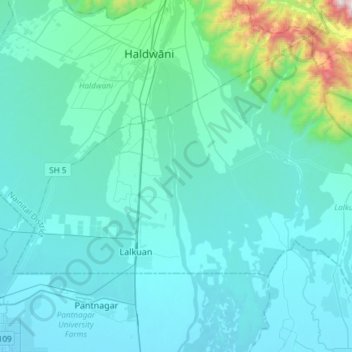
Name: Gaula topographic map, elevation, terrain.
Location: Gaula, Haldwani, Lalkuan, Nainital District, Uttarakhand, Inde (28.99411 79.53744 29.25394 79.56831)
Average elevation: 370 m
Minimum elevation: 214 m
Maximum elevation: 1,798 m
Thank you for supporting this site ❤️
Make a donation
Make a donation
Gear up for your next adventure:
As an Amazon Associate, this site earns from qualifying purchases at no extra cost to you.