Geolocate

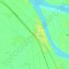
Tama City topographic map

Click on the map to display elevation.

About this map

Name: Tama City topographic map, elevation, terrain.

Location: Tama City, Suhaj, 82611, Egypt (26.87375 31.41612 26.91628 31.45957)

Average elevation: 59 m

Minimum elevation: 57 m

Maximum elevation: 68 m

Other topographic maps

Click on a map to view its topography, its elevation and its terrain.

Akhmim

Egypt > Suhaj

Average elevation: 62 m

Al Salamuni

Egypt > Suhaj

Average elevation: 108 m

Al Maragha

Egypt > Suhaj

Average elevation: 60 m

Akhmim

Egypt > Suhaj

Average elevation: 62 m

Akhmim

Egypt > Suhaj

Average elevation: 62 m

Alsalaa

Egypt > Suhaj

Average elevation: 62 m

Gear up for your next adventure:

🔪Outdoor Multitool - Versatile tool for repairs and food prep in the wild
👖Convertible Hiking Pants - Zip-off legs to adapt to changing weather conditions
🔦UV Flashlight - Detect minerals or specific insects in the dark
🥾Trail Running Shoes - Lightweight and durable shoes for trail running
🛶Waterproof Dry Bags - Keep electronics and clothes dry during river crossings

As an Amazon Associate, this site earns from qualifying purchases at no extra cost to you.