Geolocate

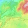
Les Combes topographic map

Click on the map to display elevation.

About this map

Name: Les Combes topographic map, elevation, terrain.

Location: Les Combes, Maîche, Montbéliard, Doubs, Bourgogne-Franche-Comté, France métropolitaine, 25120, France (47.22646 6.78796 47.26646 6.82796)

Average elevation: 826 m

Minimum elevation: 679 m

Maximum elevation: 982 m

Other topographic maps

Click on a map to view its topography, its elevation and its terrain.
25120

France > Bourgogne-Franche-Comté > Doubs > Maîche > Le Jay

Average elevation: 765 m

Gear up for your next adventure:

🧴Insect Repellent - Protect yourself from bugs during outdoor adventures
🥾Approach Boots - Comfortable boots for hiking and climbing approaches
🐕Hiking Dog Pack - Let your canine companion carry their own water and food
⛺Camping Groundsheet - Protect your tent from moisture and dirt
🧦Hiking Socks - Moisture-wicking and comfortable socks for long hikes

As an Amazon Associate, this site earns from qualifying purchases at no extra cost to you.