Geolocate

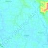
Mattoor topographic map

Click on the map to display elevation.

About this map

Name: Mattoor topographic map, elevation, terrain.

Location: Mattoor, Aluva, Ernakulam, Kerala, 683550, India (10.15103 76.40898 10.19103 76.44898)

Average elevation: 14 m

Minimum elevation: -1 m

Maximum elevation: 35 m

Other topographic maps

Click on a map to view its topography, its elevation and its terrain.
Mookkannoor

India > Kerala > Aluva > Ezhattumugham

Average elevation: 31 m

Thuravoor (Ernakulam)

India > Kerala > Aluva > Thuravoor

Average elevation: 22 m

Choornikkara

India > Kerala > Aluva > Aluva

Average elevation: 10 m

Sreemoolanagaram

India > Kerala > Aluva > Thuruth

Average elevation: 11 m

Choornikkara

India > Kerala > Aluva > Aluva

Average elevation: 10 m

Sreemoolanagaram

India > Kerala > Aluva > Thuruth

Average elevation: 11 m

Gear up for your next adventure:

🥾Lightweight Hiking Boots - Boots for comfort and mobility on long hikes
🧴Bear Spray Holster - Quick-access carry for essential Canadian wilderness safety
🧢Outdoor Cap - Protective cap for sun and rain during hikes
🥾Approach Boots - Comfortable boots for hiking and climbing approaches
🌬️Windproof Camp Stove - Efficient cooking even on exposed mountain peaks

As an Amazon Associate, this site earns from qualifying purchases at no extra cost to you.