Geolocate

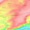
Bad Bibra topographic map

Click on the map to display elevation.

About this map

Name: Bad Bibra topographic map, elevation, terrain.

Location: Bad Bibra, An der Finne, Burgenlandkreis, Saxony-Anhalt, 06647, Germany (51.17434 11.51847 51.26148 11.64841)

Average elevation: 230 m

Minimum elevation: 108 m

Maximum elevation: 308 m

Other topographic maps

Click on a map to view its topography, its elevation and its terrain.

Hainbergsee

Germany > Saxony-Anhalt > Burgenlandkreis > Nißma > Penkwitz

Average elevation: 196 m

Gear up for your next adventure:

🥾Hiking Shoes - Durable and comfortable shoes for trail hiking
👟Trail Running Shoes - Agile footwear for fast-paced topographic exploration
🔦LED Headlamp - Hands-free lighting for early morning starts or late finishes
🥾Mountain Hiking Shoes - Shoes with superior grip for mountainous terrain
🧴Waterproofing Spray - Restore the DWR coating on jackets and tents

As an Amazon Associate, this site earns from qualifying purchases at no extra cost to you.