Geolocate

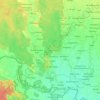
Rajipur topographic map

Click on the map to display elevation.

About this map

Name: Rajipur topographic map, elevation, terrain.

Location: Rajipur, Gauriganga, Kailali, Sudurpashchim Province, Nepal (28.73395 80.74606 28.77395 80.78606)

Average elevation: 190 m

Minimum elevation: 175 m

Maximum elevation: 212 m

Other topographic maps

Click on a map to view its topography, its elevation and its terrain.

Chure

Nepal > Sudurpashchim Province > Kailali

Average elevation: 939 m

Bhajani

Nepal > Sudurpashchim Province > Kailali

Average elevation: 152 m

Bhajani

Nepal > Sudurpashchim Province > Kailali

Average elevation: 152 m

Gear up for your next adventure:

🔦LED Flashlight - Powerful and long-lasting flashlight for camping and emergencies
🥾Trail Hiking Boots - Supportive boots for rough trails
🧥Softshell Hiking Jacket - The perfect balance of wind protection and breathability
🧳Compression Sacks - Maximize space in your backpack by shrinking gear
🧥Softshell Jacket - Windproof and breathable jacket for hiking

As an Amazon Associate, this site earns from qualifying purchases at no extra cost to you.