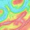
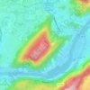
Fort de Chaudanne topographic map
Click on the map to display elevation.
Fort de Chaudanne
Le fort (de) Chaudanne ou fort Baudrand est une fortification du XIX siècle située sur la colline de Chaudanne, dans le quartier de la Grette, à Besançon (Région française de Bourgogne-Franche-Comté). À 422 m d'altitude, il se situe à 900 m au sud du centre-ville et à 900 m à l'ouest de la citadelle qu'elle domine de 60 m.
About this map

Name: Fort de Chaudanne topographic map, elevation, terrain.
Average elevation: 303 m
Minimum elevation: 235 m
Maximum elevation: 483 m
Other topographic maps
Click on a map to view its topography, its elevation and its terrain.

Fort de Planoise
France > Bourgogne-Franche-Comté > Doubs > Besançon > Aux Valières
Average elevation: 298 m