Geolocate

New River topographic map

Click on the map to display elevation.

About this map
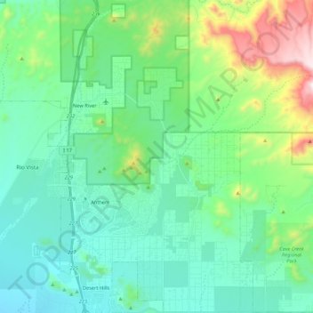
Name: New River topographic map, elevation, terrain.

Location: New River, Maricopa County, Arizona, United States (33.79880 -112.15058 33.97520 -112.02170)

Average elevation: 690 m

Minimum elevation: 483 m

Maximum elevation: 1,421 m

Gear up for your next adventure:

🕶️Polarized Sunglasses - Reduces glare from snow and water at high elevations
🧴Bear Spray Holster - Quick-access carry for essential Canadian wilderness safety
🥾Waterproof Hiking Shoes - Durable shoes for wet and rugged trails
🔪Outdoor Multitool - Versatile tool for repairs and food prep in the wild
🧤Thermal Hiking Gloves - Grip-enhanced gloves for cold-weather altitude trekking

As an Amazon Associate, this site earns from qualifying purchases at no extra cost to you.