Geolocate

Kinangop topographic map

Click on the map to display elevation.

About this map

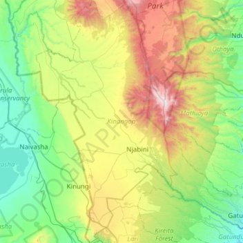
Name: Kinangop topographic map, elevation, terrain.

Location: Kinangop, Nyandarua, Central Kenya, 20319, Kenya (-0.92140 36.44259 -0.41991 36.73633)

Average elevation: 2,423 m

Minimum elevation: 1,828 m

Maximum elevation: 3,859 m

Other topographic maps

Click on a map to view its topography, its elevation and its terrain.

Mount Satima

Kenya > Nyandarua

Average elevation: 3,805 m

Gear up for your next adventure:

🧴Sunscreen SPF - Broad-spectrum sunscreen for outdoor activities
🥾Trail Running Shoes - Lightweight and durable shoes for trail running
🧤Thermal Hiking Gloves - Grip-enhanced gloves for cold-weather altitude trekking
🕶️Polarized Sunglasses - Protect your eyes with durable polarized lenses
🗺️Topographic Maps - Detailed maps to explore trails, mountains, and wilderness areas

As an Amazon Associate, this site earns from qualifying purchases at no extra cost to you.