

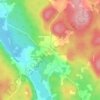
Upper Golden Grove topographic map
Click on the map to display elevation.
About this map

Name: Upper Golden Grove topographic map, elevation, terrain.
Average elevation: 95 m
Minimum elevation: 4 m
Maximum elevation: 229 m
Fundy Rural District trails, hiking, mountain biking, running and outdoor activities
Other topographic maps
Click on a map to view its topography, its elevation and its terrain.



Martin Head
Canada > New Brunswick > Fundy Rural District > Saint Martins Parish
Average elevation: 7 m