
Khed topographic map
Click on the map to display elevation.
About this map
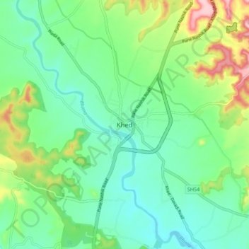
Name: Khed topographic map, elevation, terrain.
Location: Khed, Pune District, Maharashtra, 412205, India (18.81287 73.84468 18.89287 73.92468)
Average elevation: 626 m
Minimum elevation: 571 m
Maximum elevation: 761 m
Other topographic maps
Click on a map to view its topography, its elevation and its terrain.