Geolocate

Barfleur topographic map

Click on the map to display elevation.

About this map
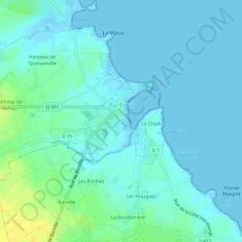
Name: Barfleur topographic map, elevation, terrain.

Location: Barfleur, Cherbourg, Manche, Normandy, Metropolitan France, 50760, France (49.66431 -1.27373 49.67344 -1.25677)

Average elevation: 5 m

Minimum elevation: -1 m

Maximum elevation: 22 m

Other topographic maps

Click on a map to view its topography, its elevation and its terrain.
Le Petit Hameau

France > Normandy > Manche > Barneville-Carteret

Average elevation: 21 m

Le Clos Versailles

France > Normandy > Manche > La Haye-du-Puits

Average elevation: 51 m

Le Valnotte

France > Normandy > Manche > Carteret

Average elevation: 35 m

Gear up for your next adventure:

⛺Family Camping Tent - Spacious tent suitable for family camping trips
🧦Thermal Socks - Warm socks for winter hiking or camping
🥾Waterproof Hiking Shoes - Durable shoes for wet and rugged trails
🦯Trekking Poles - Reduced impact on joints for steep topographic climbs
☕Camping Coffee Maker - Brew fresh coffee anywhere on the topographic map

As an Amazon Associate, this site earns from qualifying purchases at no extra cost to you.