
Thank you for supporting this site ❤️
Make a donation
Make a donation
Gear up for your next adventure:
As an Amazon Associate, this site earns from qualifying purchases at no extra cost to you.
Schöningen topographic map
Click on the map to display elevation.
Thank you for supporting this site ❤️
Make a donation
Make a donation
Gear up for your next adventure:
As an Amazon Associate, this site earns from qualifying purchases at no extra cost to you.
About this map
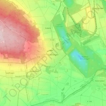
Name: Schöningen topographic map, elevation, terrain.
Location: Schöningen, Landkreis Helmstedt, Lower Saxony, 38364, Germany (52.10328 10.90791 52.17648 11.02789)
Average elevation: 139 m
Minimum elevation: 12 m
Maximum elevation: 297 m
Thank you for supporting this site ❤️
Make a donation
Make a donation
Gear up for your next adventure:
As an Amazon Associate, this site earns from qualifying purchases at no extra cost to you.