
Thank you for supporting this site ❤️
Make a donation
Make a donation
Gear up for your next adventure:
As an Amazon Associate, this site earns from qualifying purchases at no extra cost to you.
米美村 topographic map
Click on the map to display elevation.
Thank you for supporting this site ❤️
Make a donation
Make a donation
Gear up for your next adventure:
As an Amazon Associate, this site earns from qualifying purchases at no extra cost to you.
About this map
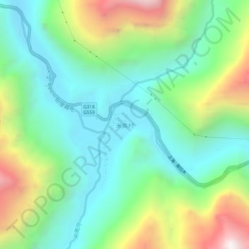
Name: 米美村 topographic map, elevation, terrain.
Location: 米美村, Yupug, Pome County, Nyingchi Prefecture, Tibet, China (29.53503 96.43291 29.57503 96.47291)
Average elevation: 3,928 m
Minimum elevation: 3,481 m
Maximum elevation: 4,899 m
Thank you for supporting this site ❤️
Make a donation
Make a donation
Gear up for your next adventure:
As an Amazon Associate, this site earns from qualifying purchases at no extra cost to you.