Geolocate

Mehlville topographic map

Click on the map to display elevation.

About this map

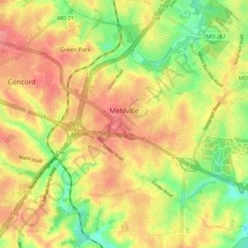
Name: Mehlville topographic map, elevation, terrain.

Location: Mehlville, Saint Louis County, Missouri, United States (38.47715 -90.35547 38.53285 -90.27653)

Average elevation: 159 m

Minimum elevation: 114 m

Maximum elevation: 193 m

Other topographic maps

Click on a map to view its topography, its elevation and its terrain.

Mattese

United States > Missouri > Saint Louis County > Mehlville

Average elevation: 162 m

Gear up for your next adventure:

🥾Trail Hiking Boots - Supportive boots for rough trails
🧥Thermal Fleece Jacket - Versatile insulation for changing mountain temperatures
🛶Canoe Life Vest - Safety vest for water sports
🥾Hiking Boots - Sturdy boots providing ankle support and traction on rugged trails
Bushcraft Tarp - Versatile emergency shelter or gear protection

As an Amazon Associate, this site earns from qualifying purchases at no extra cost to you.