Geolocate

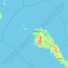
Totuban topographic map

Click on the map to display elevation.

About this map

Name: Totuban topographic map, elevation, terrain.

Location: Totuban, Masbate, Bicol Region, 5417, Philippines (12.54442 123.67189 12.58442 123.71189)

Average elevation: 61 m

Minimum elevation: 1 m

Maximum elevation: 163 m

Other topographic maps

Click on a map to view its topography, its elevation and its terrain.

Ticao Island

Philippines > Masbate

Average elevation: 23 m

San Pascual

Philippines > Masbate

Average elevation: 7 m

Burias

Philippines > Masbate

Average elevation: 18 m

Jintotolo Island

Philippines > Masbate > Jintotolo

Its elevation was recorded at around 120 feet (37 m) in 1919. A lighthouse with a tower at 51 feet (16 m) in height exists on Jintotolo island.

Average elevation: 6 m

Sagawsawan River

Philippines > Masbate > Tabuc

Average elevation: 119 m

Ticao Island

Philippines > Masbate

Average elevation: 23 m

Burias

Philippines > Masbate

Average elevation: 18 m

Manocmanoc Island

Philippines > Masbate

Average elevation: 0 m

Ticao Island

Philippines > Masbate

Average elevation: 23 m

Ticao Island

Philippines > Masbate

Average elevation: 23 m

Masbate

Philippines > Masbate

Average elevation: 26 m

Puro Islet

Philippines > Masbate > Pandan

Average elevation: 15 m

Gilotongan

Philippines > Masbate

Average elevation: 0 m

Gear up for your next adventure:

☕Camping Coffee Maker - Brew fresh coffee anywhere on the topographic map
🥽Outdoor Goggles - Protective eyewear for outdoor activities
🗺️Topographic Maps - Detailed maps to explore trails, mountains, and wilderness areas
🛰️Satellite Messenger - Emergency communication for areas with no cell service
💧Filtered Water Bottle - Safe drinking water on the go

As an Amazon Associate, this site earns from qualifying purchases at no extra cost to you.