Geolocate

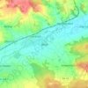
Hamburg topographic map

Click on the map to display elevation.

Hamburg

The neighbourhoods of Neuenfelde, Cranz, Francop and Finkenwerder are part of the Altes Land (old land) region, the largest contiguous fruit-producing region in Central Europe. Neugraben-Fischbek has Hamburg's highest elevation, the Hasselbrack at 116.2 metres (381 ft) AMSL. Hamburg borders the states of Schleswig-Holstein and Lower Saxony.

Wikipedia (CC-BY-SA 3.0)

About this map

Name: Hamburg topographic map, elevation, terrain.

Location: Hamburg, Germany (53.39511 8.10450 54.02765 10.32528)

Average elevation: 27 m

Minimum elevation: -6 m

Maximum elevation: 157 m

Other topographic maps

Click on a map to view its topography, its elevation and its terrain.

People Park

Germany > Berlin

Average elevation: 56 m

Knoll

Germany > Thuringia > Saale-Holzland-Kreis > Bucha

Average elevation: 357 m

Wind

Germany > Bavaria > Landkreis Bamberg

Average elevation: 284 m

Gear up for your next adventure:

🧊Insulated Water Bottle - Keeps drinks cold in summer and prevents freezing in winter
🛶Kayak Dry Bag - Waterproof storage for kayaking adventures
🦟Insect Repellent - Keep mosquitoes and black flies away in wooded areas
🥾Approach Boots - Comfortable boots for hiking and climbing approaches
🧴First Aid Kit - Essential first aid supplies for outdoor emergencies

As an Amazon Associate, this site earns from qualifying purchases at no extra cost to you.