
Thank you for supporting this site ❤️
Make a donation
Make a donation
Gear up for your next adventure:
As an Amazon Associate, this site earns from qualifying purchases at no extra cost to you.
Serra topographic map
Click on the map to display elevation.
Thank you for supporting this site ❤️
Make a donation
Make a donation
Gear up for your next adventure:
As an Amazon Associate, this site earns from qualifying purchases at no extra cost to you.
About this map
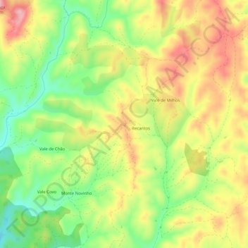
Name: Serra topographic map, elevation, terrain.
Location: Serra, Luzianes-Gare, Odemira, Beja, 7665-891, Portugal (37.55121 -8.54218 37.59121 -8.50218)
Average elevation: 141 m
Minimum elevation: 57 m
Maximum elevation: 225 m
Thank you for supporting this site ❤️
Make a donation
Make a donation
Gear up for your next adventure:
As an Amazon Associate, this site earns from qualifying purchases at no extra cost to you.