Geolocate

Cole City topographic map

Click on the map to display elevation.
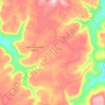
About this map

Name: Cole City topographic map, elevation, terrain.

Location: Cole City, Dade County, Georgia, United States (34.91681 -85.57056 34.97484 -85.50002)

Average elevation: 417 m

Minimum elevation: 243 m

Maximum elevation: 527 m

Other topographic maps

Click on a map to view its topography, its elevation and its terrain.

West Brow

United States > Georgia > Dade County

Average elevation: 426 m

Head River

United States > Georgia > Dade County

Average elevation: 585 m

Trenton

United States > Georgia > Dade County

Average elevation: 280 m

New England

United States > Georgia > Dade County

Average elevation: 257 m

Wildwood

United States > Georgia > Dade County

Average elevation: 258 m

Cole City

United States > Georgia > Dade County

Average elevation: 431 m

Gear up for your next adventure:

🥤Collapsible Travel Cup - Saves space and weight in your mess kit
🥾Waterproof Hiking Boots - Boots keeping your feet dry in wet conditions
🎒Backpack Rain Cover - External shield to keep your entire pack dry
🚲Heavy Duty Bike Lock - Secure your bike at the trailhead or during stops
🥾Waterproof Trail Shoes - Shoes designed to handle wet terrain

As an Amazon Associate, this site earns from qualifying purchases at no extra cost to you.