
District de Luolong topographic map
Interactive map
Click on the map to display elevation.
About this map
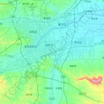
Name: District de Luolong topographic map, elevation, terrain.
Location: District de Luolong, Luoyang, Henan, Chine (34.50572 112.35652 34.71201 112.65452)
Average elevation: 198 m
Minimum elevation: 115 m
Maximum elevation: 842 m
Other topographic maps
Click on a map to view its topography, its elevation and its terrain.
District de Luolong
Chine > Henan > District de Luolong > District de Luolong > 开元路街道
District de Luolong, 开元路街道, District de Luolong, Luoyang, Henan, 471022, Chine
Average elevation: 221 m