Geolocate

Bucerias topographic map

Click on the map to display elevation.

About this map

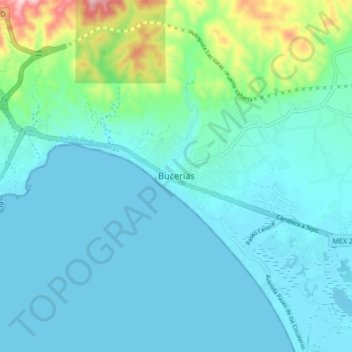
Name: Bucerias topographic map, elevation, terrain.

Location: Bucerias, Bahía de Banderas, Nayarit, 13098, Mexico (20.71559 -105.37435 20.79559 -105.29435)

Average elevation: 48 m

Minimum elevation: -1 m

Maximum elevation: 307 m

Gear up for your next adventure:

🥾Trail Hiking Socks - Comfortable socks to prevent blisters and fatigue
🧰Survival Kit - Essential gear for emergencies in the wilderness
💧Hydration Pack - Hands-free hydration system for long hikes
🧴Insect Repellent - Protect yourself from bugs during outdoor adventures
🛌Down Sleeping Bag - Superior warmth-to-weight ratio for cold nights

As an Amazon Associate, this site earns from qualifying purchases at no extra cost to you.