
卡攻乡 topographic map
Interactive map
Click on the map to display elevation.
About this map
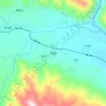
Name: 卡攻乡 topographic map, elevation, terrain.
Location: 卡攻乡, 甘孜县, 甘孜藏族自治州, 四川省, 中国 (31.61778 99.69841 31.69778 99.77841)
Average elevation: 3,687 m
Minimum elevation: 3,387 m
Maximum elevation: 4,666 m