Geolocate

Culver topographic map

Click on the map to display elevation.

About this map

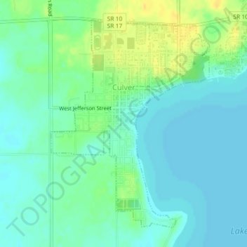
Name: Culver topographic map, elevation, terrain.

Location: Culver, Marshall County, Indiana, 46511, United States (41.20356 -86.43359 41.22629 -86.41052)

Average elevation: 230 m

Minimum elevation: 222 m

Maximum elevation: 246 m

Other topographic maps

Click on a map to view its topography, its elevation and its terrain.

Harris

United States > Indiana > Marshall County

Average elevation: 255 m

Gear up for your next adventure:

🥾Light Trekking Boots - Supportive boots for multi-day treks
🛶Kayak Dry Bag - Waterproof storage for kayaking adventures
🥾Lightweight Hiking Boots - Boots for comfort and mobility on long hikes
🛏️Camping Sleeping Mat - Comfortable mats for sleeping outdoors
🧥Waterproof Jacket - Lightweight rain jackets for hiking and outdoor activities

As an Amazon Associate, this site earns from qualifying purchases at no extra cost to you.