Geolocate

Cités de Bezance topographic map

Click on the map to display elevation.

About this map
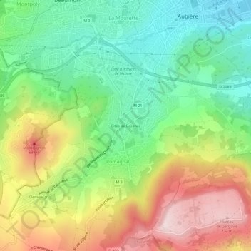
Name: Cités de Bezance topographic map, elevation, terrain.

Location: Cités de Bezance, Romagnat, Clermont-Ferrand, Puy-de-Dôme, Auvergne-Rhône-Alpes, France métropolitaine, 63540, France (45.71378 3.08027 45.75378 3.12027)

Average elevation: 516 m

Minimum elevation: 359 m

Maximum elevation: 742 m

Other topographic maps

Click on a map to view its topography, its elevation and its terrain.

63540

France > Auvergne-Rhône-Alpes > Puy-de-Dôme > Romagnat

Average elevation: 564 m

Gear up for your next adventure:

🧦Outdoor Socks - Durable socks designed for hiking and outdoor sports
👟Sport Hiking Sandals - Breathable footwear for water crossings and camp rest
💡LED Headlamp - Hands-free illumination for night hiking and camping
🧥Softshell Hiking Jacket - The perfect balance of wind protection and breathability
🧰Emergency Multi-Tool - Compact multi-tool for outdoor survival

As an Amazon Associate, this site earns from qualifying purchases at no extra cost to you.