
Seohara topographic map
Click on the map to display elevation.
Seohara
Seohara is located at 29°13′N 78°35′E / 29.22°N 78.58°E / 29.22; 78.58. It has an average elevation of 211 metres (692 feet).
About this map
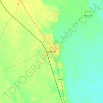
Name: Seohara topographic map, elevation, terrain.
Location: Seohara, Dhampur, Bijnor, Uttar Pradesh, 246746, India (29.16716 78.54422 29.24716 78.62422)
Average elevation: 222 m
Minimum elevation: 211 m
Maximum elevation: 232 m