
Helpt topographic map
Click on the map to display elevation.
About this map
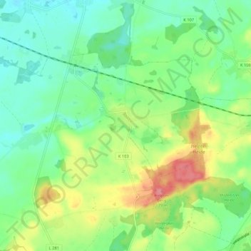
Name: Helpt topographic map, elevation, terrain.
Average elevation: 111 m
Minimum elevation: 81 m
Maximum elevation: 169 m
Other topographic maps
Click on a map to view its topography, its elevation and its terrain.
Helpter Berg
Deutschland > Mecklenburg-Vorpommern > Mecklenburgische Seenplatte > Woldegk
Die aus der Pommern-Phase der Weichsel-Eiszeit stammende Endmoräne wurde nach der 2,4 Kilometer nordnordwestlich liegenden Ortschaft Helpt benannt. Der bewaldete Höhenzug liegt im Osten des Landkreises Mecklenburgische Seenplatte rund neun Kilometer westsüdwestlich von Strasburg (Uckermark), etwa drei…
Average elevation: 128 m
Groß Daberkow
Deutschland > Mecklenburg-Vorpommern > Mecklenburgische Seenplatte > Woldegk
Average elevation: 115 m