Geolocate

Uphill topographic map

Click on the map to display elevation.

About this map

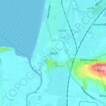
Name: Uphill topographic map, elevation, terrain.

Location: Uphill, North Somerset, England, BS23 4XE, United Kingdom (51.30307 -2.99878 51.34307 -2.95878)

Average elevation: 10 m

Minimum elevation: -1 m

Maximum elevation: 123 m

Gear up for your next adventure:

🔨Vehicle Emergency Tool - Safety tool for remote road trips to trailheads
🔦LED Headlamp - Hands-free lighting for early morning starts or late finishes
🥾Waterproof Trail Shoes - Shoes designed to handle wet terrain
👟Leg Gaiters - Keep debris, mud, and snow out of your boots
🥾Trail Hiking Socks - Comfortable socks to prevent blisters and fatigue

As an Amazon Associate, this site earns from qualifying purchases at no extra cost to you.