
Thank you for supporting this site ❤️
Make a donation
Make a donation
Gear up for your next adventure:
As an Amazon Associate, this site earns from qualifying purchases at no extra cost to you.
Petit-Fays topographic map
Click on the map to display elevation.
Thank you for supporting this site ❤️
Make a donation
Make a donation
Gear up for your next adventure:
As an Amazon Associate, this site earns from qualifying purchases at no extra cost to you.
About this map
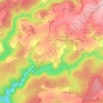
Name: Petit-Fays topographic map, elevation, terrain.
Location: Petit-Fays, Bièvre, Dinant, Namen, Wallonië, België (49.88058 4.93065 49.91507 4.97945)
Average elevation: 358 m
Minimum elevation: 224 m
Maximum elevation: 426 m
Thank you for supporting this site ❤️
Make a donation
Make a donation
Gear up for your next adventure:
As an Amazon Associate, this site earns from qualifying purchases at no extra cost to you.